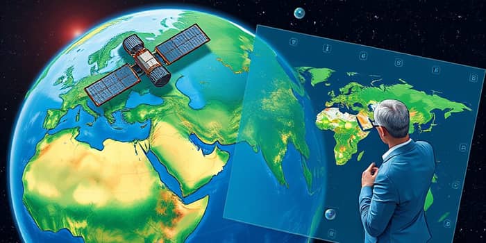
In a rapidly changing world, the intersection of finance and environmental stewardship has never been more critical. Geospatial Intelligence (GEOINT) unlocks the power of geospatial intelligence to reveal sustainable investment pathways that balance profit and planet. By fusing satellite imagery, AI analytics, and on-the-ground sensor data, investors gain the clarity needed to support projects that deliver both financial returns and positive environmental impact.
This article explores how GEOINT transforms traditional due diligence, moving from static annual reports to dynamic, near-real-time insights. We’ll examine key technologies, practical applications, quantitative outcomes, strategic benefits, and the challenges that lie ahead. Our journey demonstrates how investors can harness location-based data to build resilient portfolios and foster a healthier planet.
Geospatial Finance, also called Spatial Finance, integrates holistic view of environmental risks into every stage of investment decision-making. By mapping carbon emissions, deforestation hotspots, water stress zones, and biodiversity loss, investors can quantify ecological exposure at the asset and portfolio levels. This approach elevates traditional financial metrics by embedding natural capital—such as ecosystem services—into valuations.
With GEOINT, risk assessment evolves from broad-brush estimates to pinpoint accuracy. Asset-level monitoring enables early identification of environmental threats, regulatory compliance gaps, and reputational risks. The result is a more resilient, future-proof investment strategy that aligns with global sustainability commitments and shareholder expectations.
At the heart of geospatial intelligence lies a robust technology stack that captures, processes, and analyzes vast streams of data:
Modern satellites deliver high-frequency global updates on land use, crop health, and pollution levels. GIS platforms layer these feeds with socio-economic and regulatory data, crafting multidimensional risk profiles. AI models then automate anomaly detection—spotting illegal logging or unreported emissions—while IoT sensors provide ground-truth validation, closing gaps in remote observations.
Geospatial intelligence powers a suite of applications that guide sustainable capital flows and operational stewardship:
By overlaying ESG ratings with precise location data, investors screen assets against environmental thresholds more reliably than ever. For supply chains, GEOINT ensures supply chain traceability and compliance, tracking farm-to-fork agricultural practices, certifying responsible sourcing, and verifying labor standards in real time.
True impact measurement demands rigorous, spatially explicit metrics. Leading practitioners report:
These figures underscore the tangible benefits of granular land feature monitoring. Investors can track reforestation success, quantify water savings, and verify compliance against net-zero deforestation commitments, all through spatial dashboards that update weekly or even daily.
Integrating geospatial intelligence into financial workflows delivers multiple strategic advantages:
By adopting proactive risk mitigation strategies, investors avoid regulatory fines and reputational damage. At the same time, they uncover untapped prospects in sustainable agriculture, renewable energy siting, and conservation finance that traditional analysis might overlook.
Despite its promise, geospatial intelligence faces several hurdles. Data consistency and harmonization remain issues, as disparate ESG frameworks and rating methodologies can yield conflicting scores. Bridging these gaps demands open standards, collaborative industry consortia, and interoperable platforms that align geospatial data with financial disclosures.
Coverage limitations persist for metrics such as soil health or pollinator impact, yet emerging sensors and AI models are narrowing these blind spots. Regulatory drivers, from the Task Force on Climate-related Financial Disclosures (TCFD) to the Task Force on Nature-related Financial Disclosures (TNFD), will compel wider adoption of spatially explicit sustainability reporting.
The evolution of geospatial intelligence marks a paradigm shift in sustainable investment. By weaving location-based insights into every phase of the financial lifecycle, investors gain the foresight needed to protect assets, deliver measurable environmental benefits, and generate enduring returns. The result is a more transparent, accountable, and regenerative global financial system.
As technology advances and data ecosystems mature, GEOINT will become indispensable. Its ability to spotlight risk and opportunity with unprecedented clarity empowers investors to champion projects that heal landscapes, conserve resources, and uplift communities. In doing so, Geospatial Intelligence doesn’t just map our world—it helps us restore it for generations to come.
References